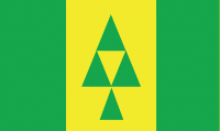
Prince Albert (Prince Albert)
 |
The area was named kistahpinanihk by the Cree, which translates to "sitting pretty place", "great meeting place" or "meeting place".
The first trading post set up in the area was built in 1776 by Peter Pond. James Isbister, an Anglo-Métis employee of the Hudson's Bay Company, settled on the site of the current city in 1862. He farmed there until 1866, and had been joined by a number of families who called the site Isbister's Settlement.
The community received a boost in 1866 when Reverend James Nisbet, a Canada Presbyterian Church minister arrived to establish a mission for the Cree. Nisbet named the mission after Albert, Prince Consort, husband of Queen Victoria, who had died in 1861, from whom the present city derives its name. In 1879 the Presbyterian Church brought out Lucy Margaret Baker to run the local mission school. During the same year, the local Freemasons established the first lodge in what is now the province of Saskatchewan: Kinistino Lodge No. 1, which still exists. "The Mission", the settlement centrally located, and "Porter Town", located to the west, were the two communities that would come together to form what is now Prince Albert. The settlement east of Prince Albert was termed Goschen before finally amalgamated, however East Prince Albert still appears on a 1924 map.
In 1884, Honore Jaxon and James Isbister were involved in the movement which brought Louis Riel back to Canada. Riel returned from the United States following a political exile resulting from the Red River Rebellion that had occurred in 1869–1870. Five hundred people gathered to hear Riel speak one month after his return.
In the North-West Rebellion of the 1885, Prince Albert Volunteers bore the heaviest casualties of the fighting at the Battle of Duck Lake. Surrounding settlers took refuge with the North-West Mounted Police in a hastily improvised stockade at Prince Albert, fearing an attack by Gabriel Dumont, which never came. After the Battle of Batoche, Major General Frederick Middleton marched to Prince Albert to relieve the town. Prince Albert, with a population of about 800 people, was incorporated as a town the same year under its first mayor, Thomas McKay. In 1904, the settlement was incorporated as the City of Prince Albert. Its government is of a council-mayor type.
Prince Albert was the capital of the District of Saskatchewan, a regional administrative division of what then constituted the North-West Territories. The District of Saskatchewan was formed on May 8, 1882, and named Prince Albert as its capital. This ended in 1905 when Saskatchewan became a province and Regina was designated the new provincial capital.
Prince Albert was one of the rival candidates to house either the University of Saskatchewan or the Saskatchewan Federal Penitentiary. The university was built in Saskatoon and the penitentiary was built in Prince Albert in 1911.
The federal constituency of Prince Albert has been represented by three prime ministers of Canada:
* John Diefenbaker, 13th Prime Minister (1957–1963), became the Member of Parliament for Lake Centre in 1940, and when that riding was abolished in 1952, represented Prince Albert from 1953 until his death in 1979.
Map - Prince Albert (Prince Albert)
Map
Country - Canada
 |
 |
| Flag of Canada | |
Indigenous peoples have continuously inhabited what is now Canada for thousands of years. Beginning in the 16th century, British and French expeditions explored and later settled along the Atlantic coast. As a consequence of various armed conflicts, France ceded nearly all of its colonies in North America in 1763. In 1867, with the union of three British North American colonies through Confederation, Canada was formed as a federal dominion of four provinces. This began an accretion of provinces and territories and a process of increasing autonomy from the United Kingdom. This widening autonomy was highlighted by the Statute of Westminster 1931 and culminated in the Canada Act 1982, which severed the vestiges of legal dependence on the Parliament of the United Kingdom.
Currency / Language
| ISO | Currency | Symbol | Significant figures |
|---|---|---|---|
| CAD | Canadian dollar | $ | 2 |
| ISO | Language |
|---|---|
| EN | English language |
| FR | French language |
| IU | Inuktitut |


